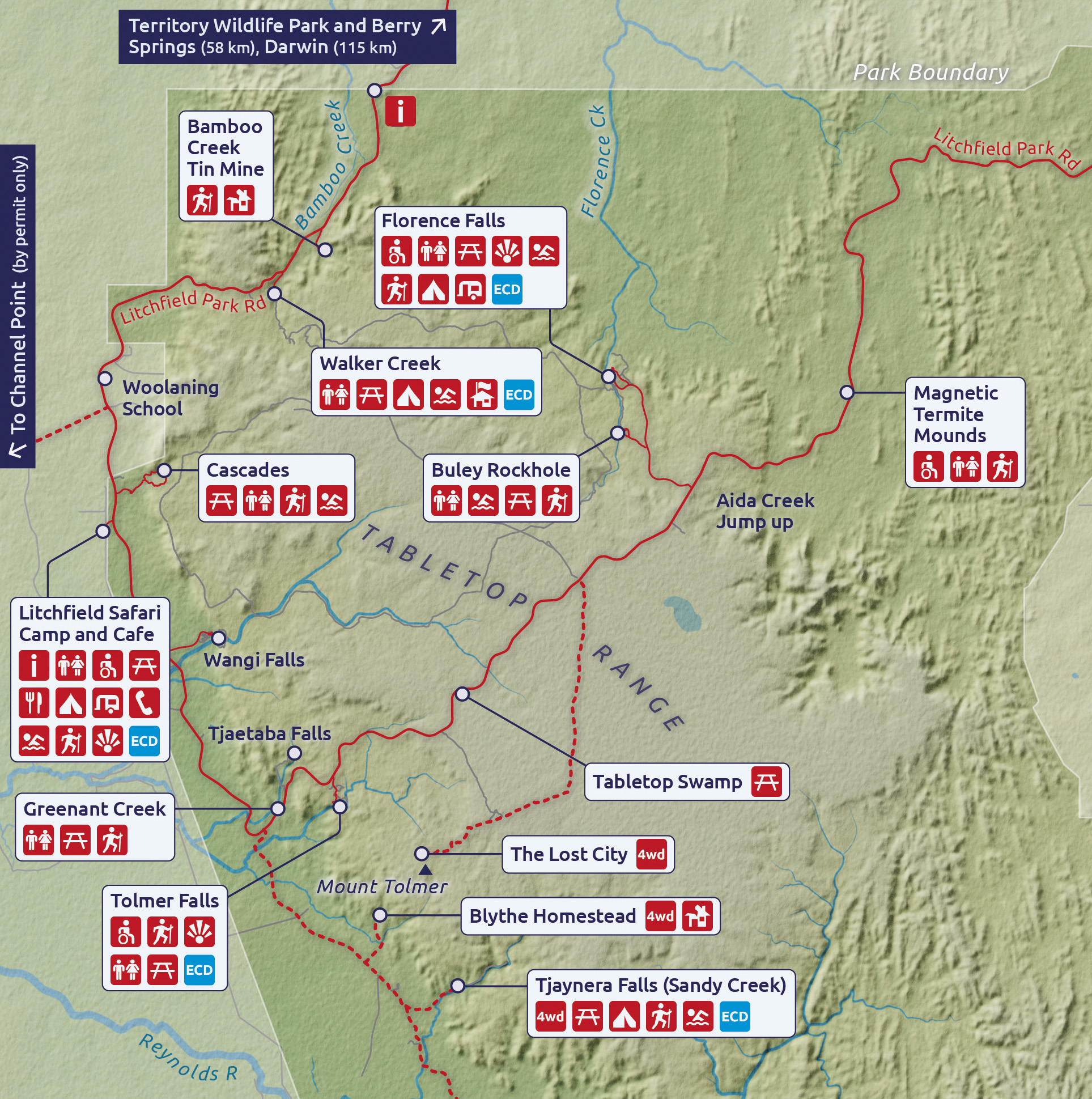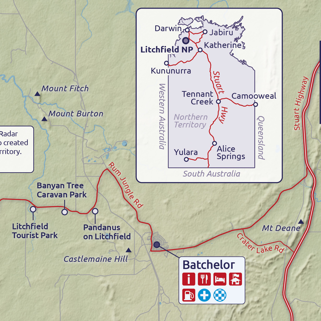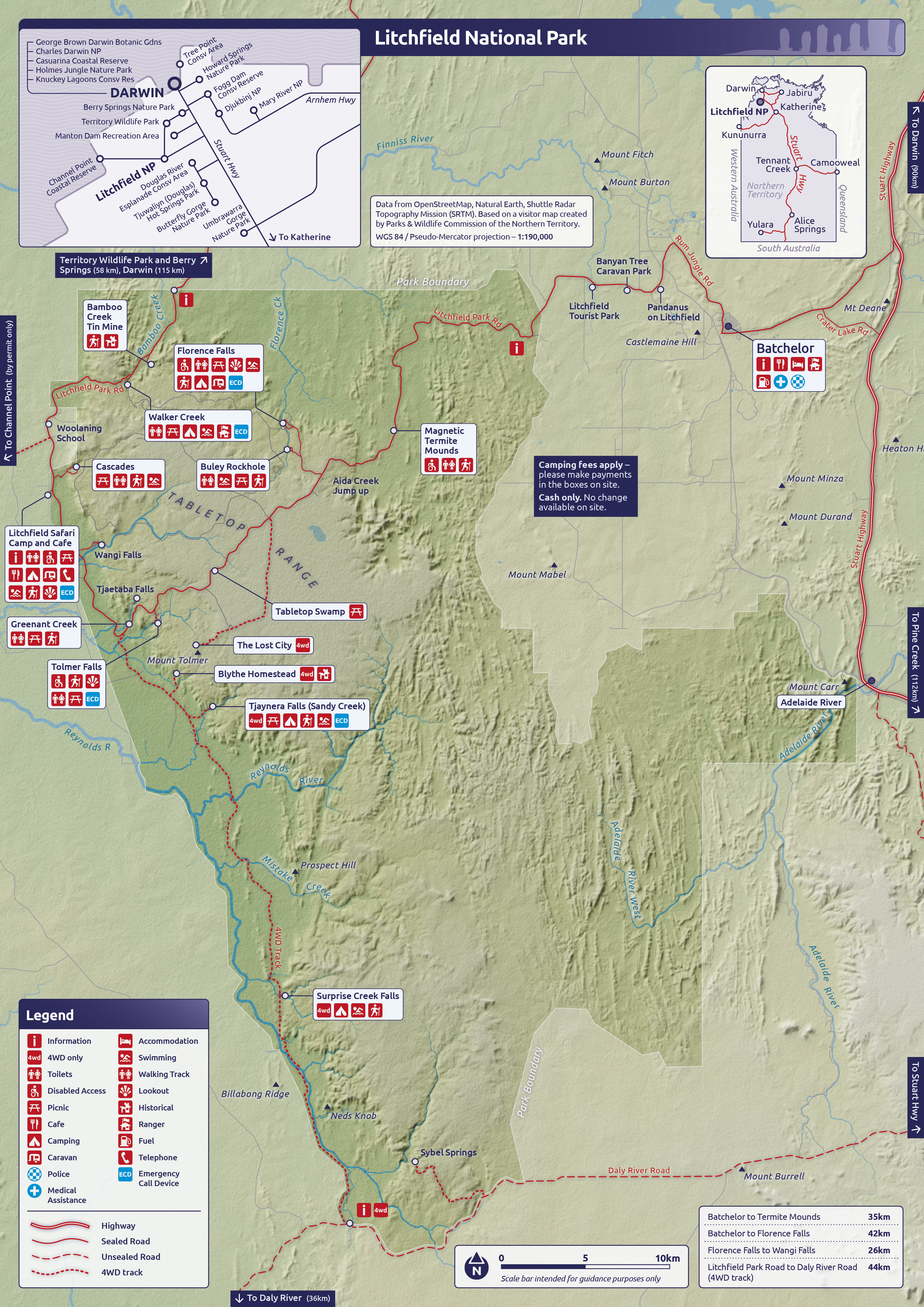
Litchfield National Park (Colour)
Made in QGIS, Blender, Photoshop, Indesign and Illustrator
Made using data from OpenStreetMap, Natural Earth, and Shuttle Radar Topography Mission (SRTM)
Self Initiated
A3 Poster format
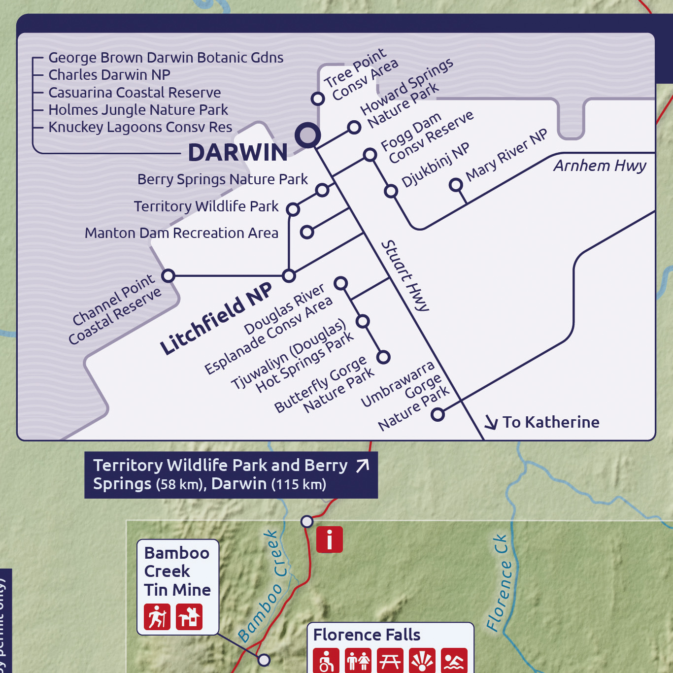
Made in QGIS, Blender, Photoshop, Indesign and Illustrator
Made using data from OpenStreetMap, Natural Earth, and Shuttle Radar Topography Mission (SRTM)
Self Initiated
A3 Poster format